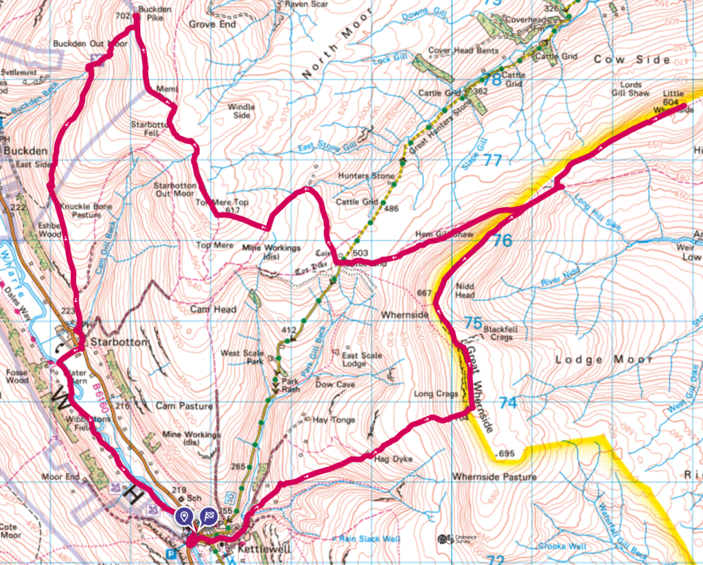
There are several Simms around the Kettlewell area in the Yorkshire Dales. You could argue that there are eleven in the local area which you could potentially summit if you started somewhere around Kettlewell / Buckden. Not all in one day though, of course.
My route planning is fairly simple. Using my online subscription to OS Maps, I start a route creation by selecting a summit. I then select another summit that I would like to do within the same walk and allow OS Maps to string a viable path together between the two. I repeat this for as many summits as I think I can do within one activity. Once I’ve got a route between the desired summits, I then look for a car park somewhere between the first and final summits, add this onto the route, and see if the total distance is reasonable to be completed in one walk / run. If not, I start the process again, with less summits.
I took quite a bit of time planning around these eleven summits, and have come to the conclusion that it will take four days to tick them all off. This is frustrating given how far I have to travel to get there. They are so close, but just far enough away from each other to put them into one activity.
The choice for this weekend’s hike then, was to start in Kettlewell and summit Great Whernside, Little Whernside and Buckden Pike.
Kettlewell is a small village but there are several places to park. I parked in the National Park car park, which is on the left as you cross the bridge over the River Wharfe (if you’re coming in from the south). Parking is £5.50 for an all day ticket. It’s a small car park, but there are some rather nice toilets just to the north, next to the payment machine. There is also an alternative car park on the other side of the road, advertising all day parking for £3 via a handmade sign.
Parking what3words: thinnest.sweetly.dine
Great Whernside
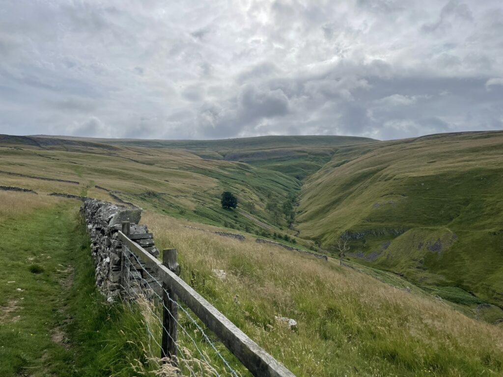
From the car park, I headed straight up to Great Whernside, passing the Hag Dyke Hostel on the way. The path up to the hostel is grassy, but is easy to follow, and there are some cracking views of the valley to the right as you ascend.
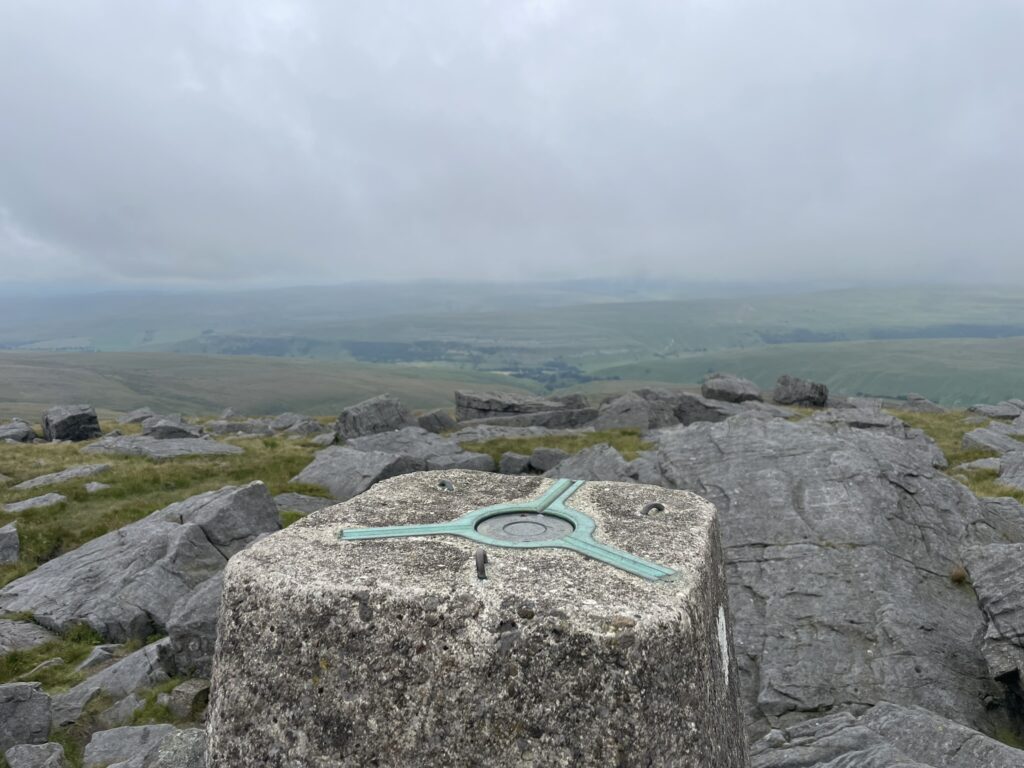
Beyond the hostel, the immediate path is more like something you would experience in the Peak District. Rocky steps as you ascend to the next plateau. From here, pretty much until the end, it’s typically Yorkshire Dales. Grass, mud, bogs. Once you hit the trig point at Great Whernside, you need to turn left, heading north towards Little Whernside. I misunderstood the path on my watch and mistakenly went over the style directly behind Great Whernside. I then had to take the next one, back over the fence, to get back on the correct path.
Little Whernside
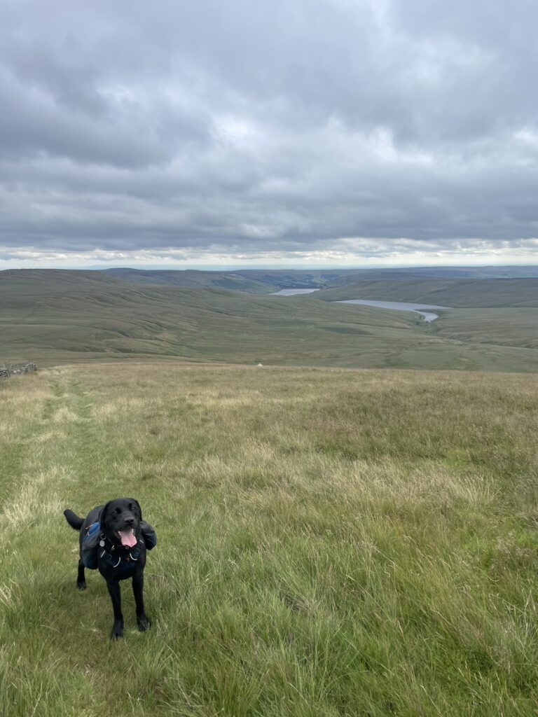
The path (?) between the two Whernside’s is tough going. There’s not much on the ground, aside from some quad bike tracks, that indicate exactly where the path is. The grass is long, and the ground beneath it is boggy. There are some nice views over towards Angram and Scar House reservoirs though.
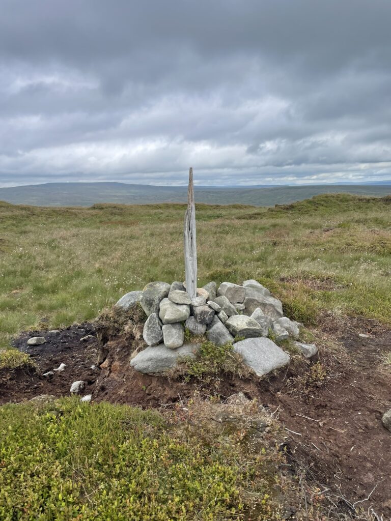
Once on the top section of Little Whernside, there’s soft peat everywhere. You will get muddy. I wouldn’t worry too much about avoiding it, just stick to the wall / fence, along this whole section, keeping it on your left. The summit is actually on the other side of the fence but, given the access laws around ground over 600 m, I quickly hopped over to touch the summit before returning back to the path and retracing my steps back towards Great Whernside.
There is a gate in the wall as you head down from Great Whernside. It’s worth noting it on your way towards the second summit, as you need to take it when coming back to head towards Buckden Pike. Once through the gate, the path is mixed. One minute it’s clear, the next you’re wondering where it’s gone. Good nav is required to ensure you don’t get lost. In good visibility, you should be able to see the road in the distance. That’s your bearing.
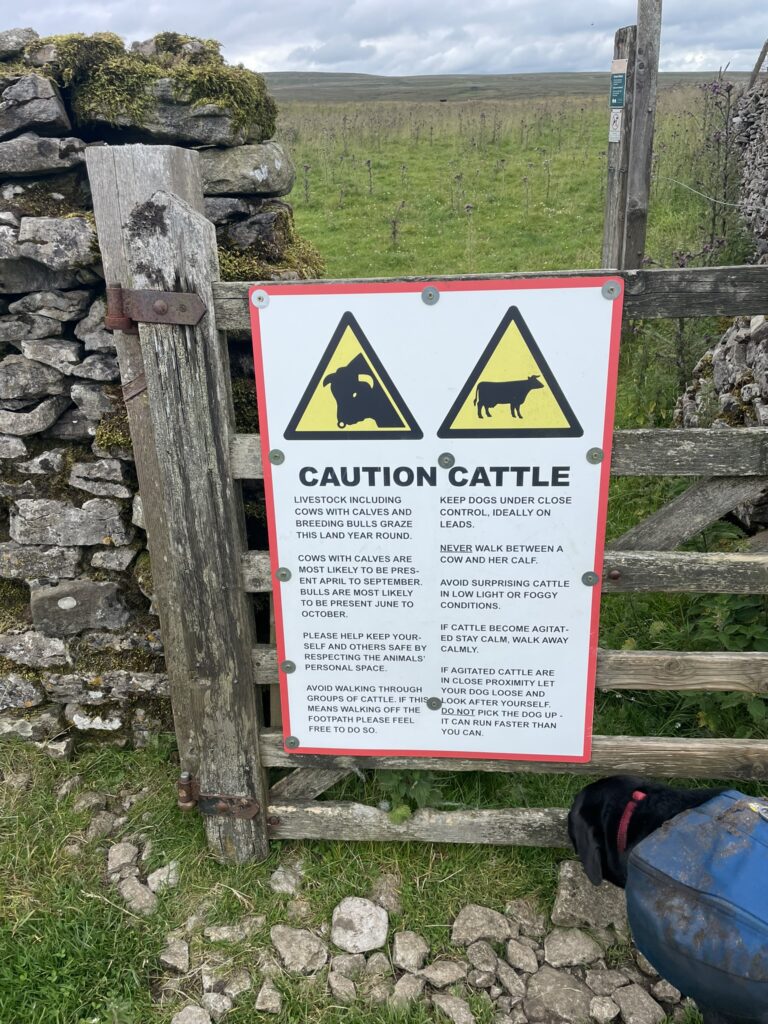
Before reaching the road, I went through a gate warning of a field containing cows and their calves along with breeding bulls. Admittedly, I’ve never had a bad experience with a cow, but I’m still terribly scared of them. I’m not sure I’ve ever moved through a field as quickly as I did this one. Crossing the road, we stopped for a spot of lunch before starting our ascent of Buckden Pike.
Buckden Pike
The route up to Buckden Pike is again full of overgrown, marshy ground. I lost the path several times, but used the track on my watch to ensure I was heading in the right direction at least. I fell into a bog at one point; the ground being far less solid than I was expecting. It was as deep as my crotch, and required some fast thinking to get out of. Got to love the Dales!
Aside from the ground, it’s not a tough climb. I noted that I had done more than half of the day’s total ascent when summiting Great Whernside. There was a semi-steep climb, followed by a plateau, and then a more gradual climb to the summit. On the way up, I came across a war-time memorial cross. It was difficult to make out what it said, so I had a search when I got home.
…In memory of five Polish R.A.F airmen who died here on 31/1/42.
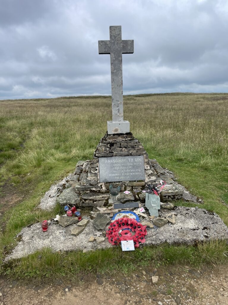
Apparently, it was later discovered that this was the wrong date, and that the flight log book entry was actually the day before.
Heading on from the memorial is more grass, more bogs. You actually need to be on the other side of the wall but, especially with a dog in tow, it’s best to wait until you reach the summit, as then you only have to scale one stile. If you cross the wall earlier, there’s several more that you need to scale before the summit.
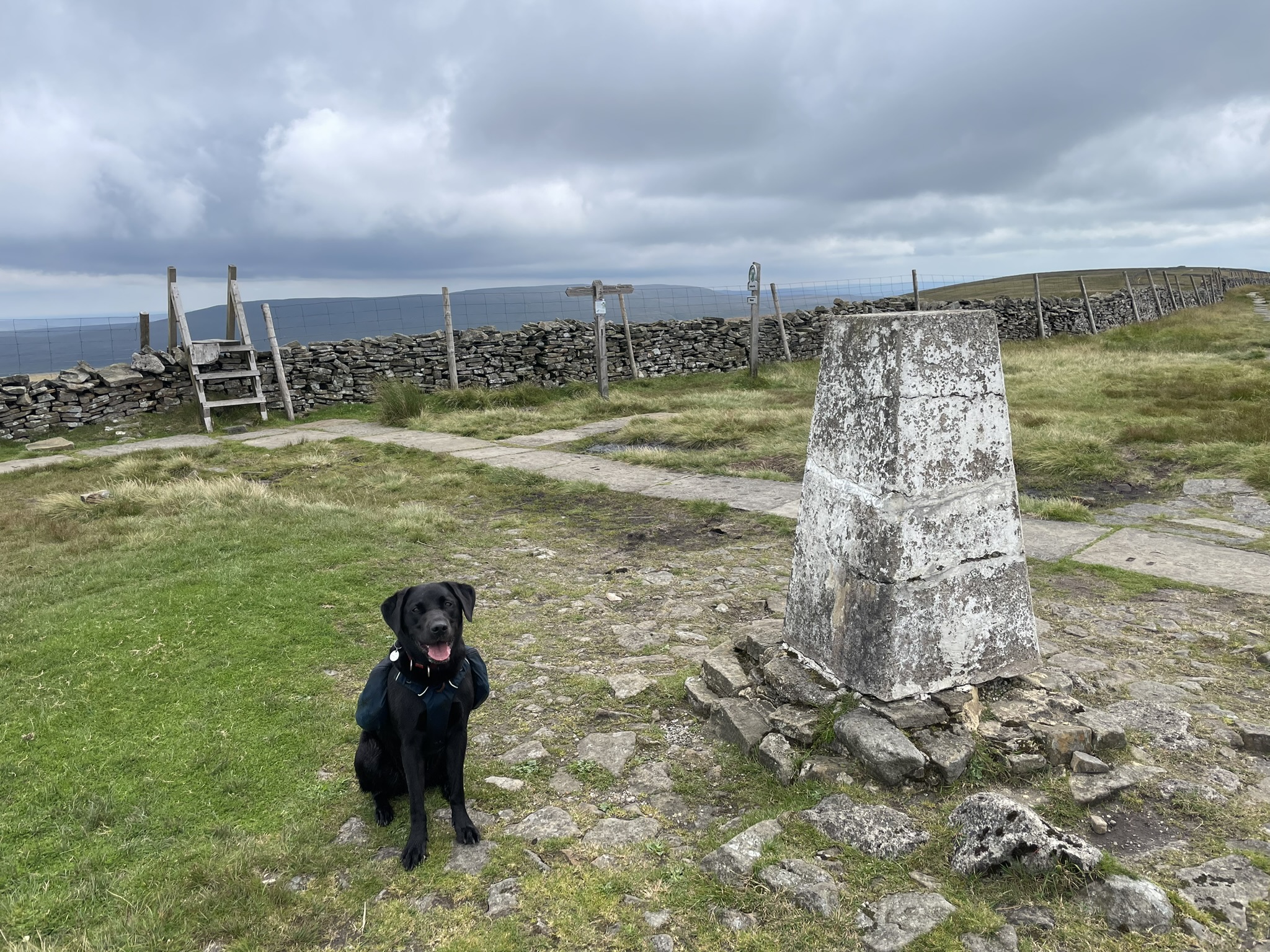
Once at the summit, rather than continue past it on the seemingly obvious path, I turned back on myself and followed the wall to climb another stile, then veering right to head toward Starbotton.

Once you reach Starbotton, there’s a gorgeous, old fashioned bridge back over the river. Archie welcomed the chance to cool down with a little dip.
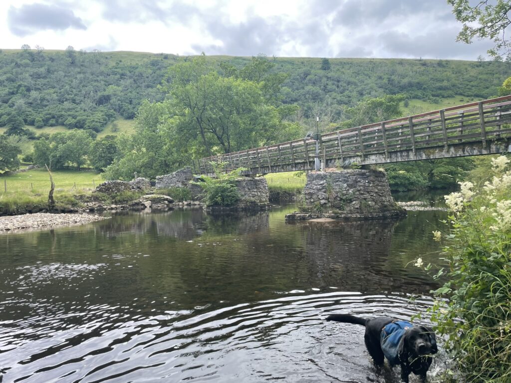
From here, we followed the banks of the river back to the car. A fairly uneventful final few miles as we were both willing the car to be closer. Me for a mug of tea, Archie for his log bone treat.
18.35 miles, 3,222 ft, 6 hours 48 minutes.